
RST Apology to Tasmanian Aboriginal people 2021.
RST Apology to Tasmanian Aboriginal people 2021.

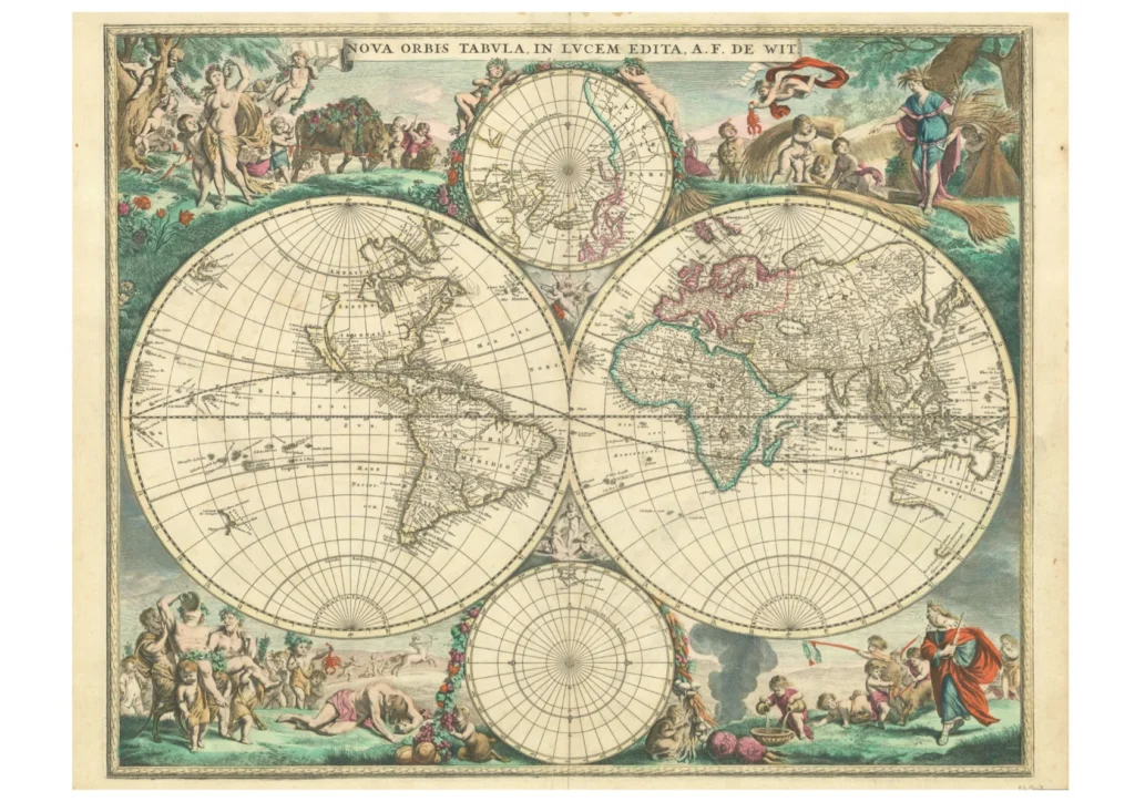


Nova orbis tabula in Lucem Edita. Late 17th century
This map is very similar to the original map first published in Amsterdam in 1660 by Frederik de Wit. The slight revision in this later (c. late seventeenth century) map is evident in the coastline of a small portion of Zeelandia Nova and the astronomical map has been omitted. Of interest is the mapped part of the southern coastline of Van Diemen’s Land. The world in two hemispheres, shows smaller maps for the Antarctic and Arctic poles in less detail than the larger maps. The highly decorative border depicts intricate coloured bacchanalian scenes. (RS Mp 8)
Original size: 55 cm x 46 cm.
Royal Society Map Collection RS Mp/8
Prints are scaled to the selected paper size allowing a 20mm margin for matting and framing. If you would like to order a map printed to the original document size then please contact the RST office for a price and to order.

The Royal Society of Tasmania acknowledges, with deep respect, the traditional owners of this land, and the ongoing custodianship of the Aboriginal people of Tasmania. The Society pays respect to Elders past, present and emerging. We acknowledge that Tasmanian Aboriginal Peoples have survived severe and unjust impacts resulting from invasion and dispossession of their Country. As an institution dedicated to the advancement of knowledge, the Royal Society of Tasmania recognises Aboriginal cultural knowledge and practices and seeks to respect and honour these traditions and the deep understanding they represent.
On 15 February 2021, the Royal Society of Tasmania offered a formal Apology to the Tasmanian Aboriginal people.