RST Apology to Tasmanian Aboriginal people 2021.
RST Apology to Tasmanian Aboriginal people 2021.

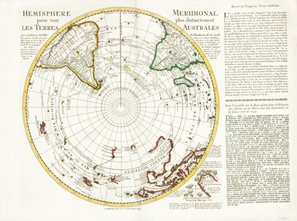


Southern Hemisphere c 1740 – 1745, de Lisle, G 1740 from The Royal Society of Tasmania’s Map Collection
Antarctic Pole: Southern Hemisphere created by G. de Lisle c 1740–1745. Neuvelle Hollande, is shown as on an earlier 1724 map – Southern Hemisphere, Antarctic Pole: 'hemisphere meridional pour voir plus distinctement le Terres Australes, par Guillaume Delisle, ou se royent les nouvelles decouvertes faites en 1739 au sud du Cap de Bonne Esperance par les ordres de Mrs. de la Compagnie des Indes. Dresse sur les memoires et sur le Carte Originale de Mrs. de Lozier Bouvet charge de cette expedition'. Terres Australes, Neuvelle Hollande, is shown as on the 1724 map, Isles de Salomonis shown in two positions – according to Dudley and according to F. Gallego. Cap de la Circoncision is shown and the position of icebergs seen by the Bouvet expedition and line of route of expedition north of the faintly indicated 'Terre de Vue' part of Southern land thought to be in Lat. 44 by some geographers. Beside the map is a plan of Circoncision and drawings of icebergs, with description in French and Dutch; also is a description of the voyage in French and Dutch. The map was published by R. & I. Ottens, Amsterdam N. (Royal Society Map Collection RS Mp 10)
During the reign of Louis XIV, his finance minister, Jean Baptiste Colbert, wanted cartographers to improve the mapping of France – especially of roads, canals and bridges – in order to stimulate the economy. Colbert also wanted accurate topographic maps so that city and political boundaries could be carefully placed. But he also required accurate charts of other areas of the world that might become useful to France. Guillaume Delisle became the Kings cartographer in 1718. This map refers to the 1738–1739 journey of exploration by Jean Baptiste Charles Bouvet de Lozier (1705–1786) in the frigates l’Aigle and la Marie, 1738. De Lozier had requested the two ships from the Company of the Indies to explore southern waters as a way of getting trade to and from the Far East. Sailing southeast from Brazil the expedition reached 52°S before returning to the Cape of Good Hope. The South Pole is shown in the middle of the map but there is no land indicated. Delisle eschewed guesswork (admitting when there was lack of knowledge about an area) and decoration but insisted on scientific accuracy and up-to-date results from voyages of exploration.
Map size: 46 cm x 45 cm - Whole sheet with description: 51 cm x 68 cm.
Royal Society Map Collection RS Mp/l0
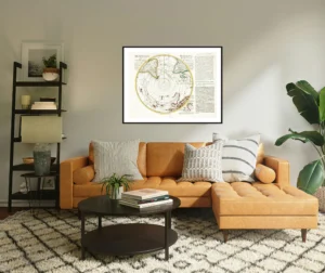
Prints are scaled to the selected paper size allowing a 20mm margin for matting and framing. If you would like to order a map printed to the original document size then please contact the RST office for a price and to order.

The Royal Society of Tasmania acknowledges, with deep respect, the traditional owners of this land, and the ongoing custodianship of the Aboriginal people of Tasmania. The Society pays respect to Elders past, present and emerging. We acknowledge that Tasmanian Aboriginal Peoples have survived severe and unjust impacts resulting from invasion and dispossession of their Country. As an institution dedicated to the advancement of knowledge, the Royal Society of Tasmania recognises Aboriginal cultural knowledge and practices and seeks to respect and honour these traditions and the deep understanding they represent.
On 15 February 2021, the Royal Society of Tasmania offered a formal Apology to the Tasmanian Aboriginal people.